
Videos
These videos walk you through varying features along our Canal embankments in the Town of Royalton and the Village of Brockport. Keeping our embankments clear from brush and debris is an important way to allow our crews to do proper inspections for seeps.

Town of Royalton, NY

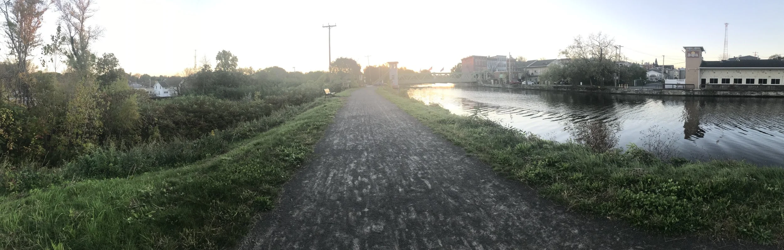
Village of Brockport, NY
Photos
Below, view examples of embankments along the NYS Canal system.
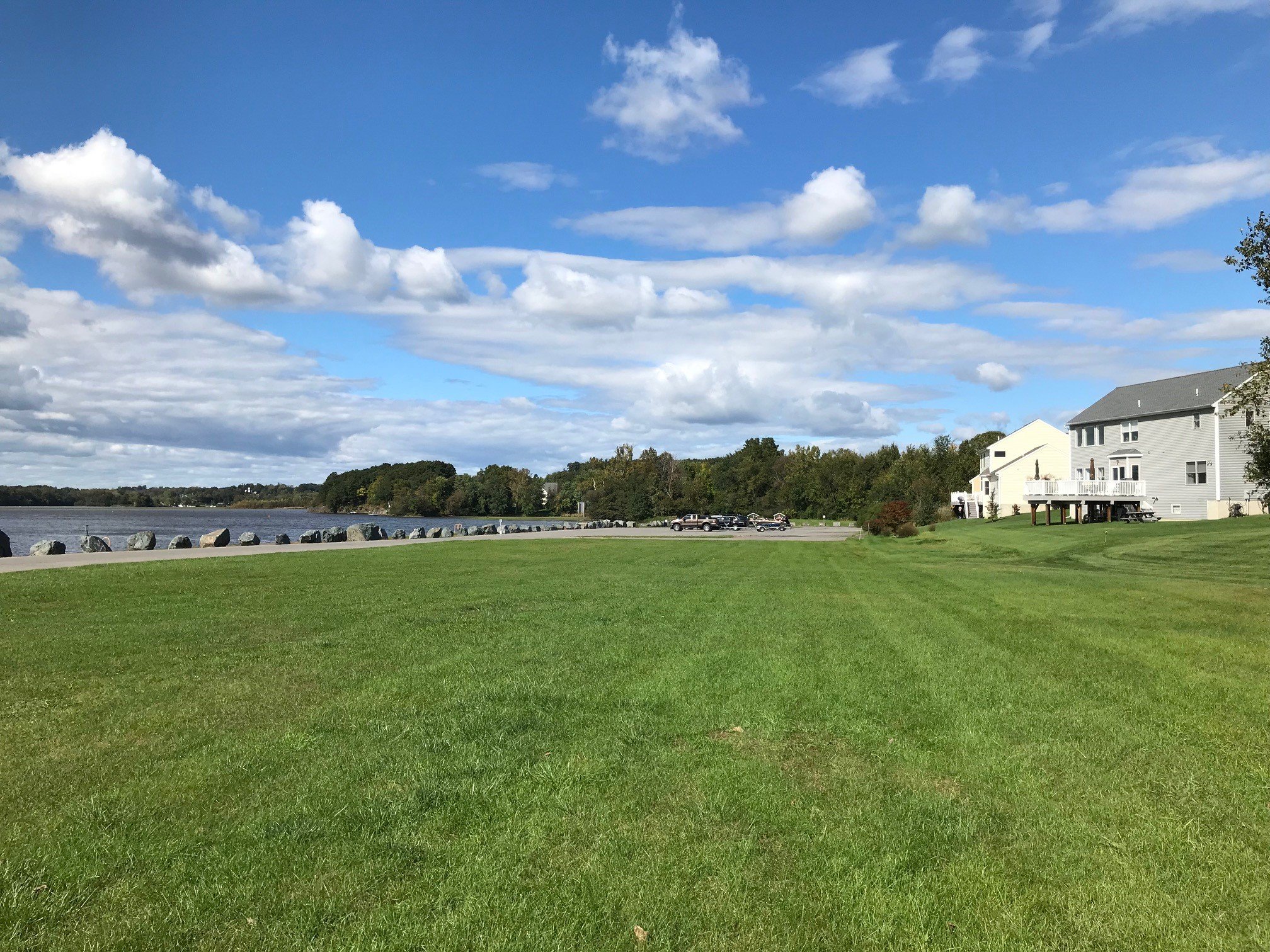
Guard Gates 1 & 2, Waterford | Image depicts a canal bank Image depicts a canal bank (not an earthen embankment– because the bank does not rise above the surrounding area) that was previously covered in dense vegetation but has been well-maintained for several years. The clear area for recreation, coupled with access to the water, has been a strong selling point for the adjacent neighborhood. that was previously covered in dense vegetation but has been well-maintained for several years. The clear area for recreation, coupled with access to the water, has been a strong selling point for the adjacent neighborhood.
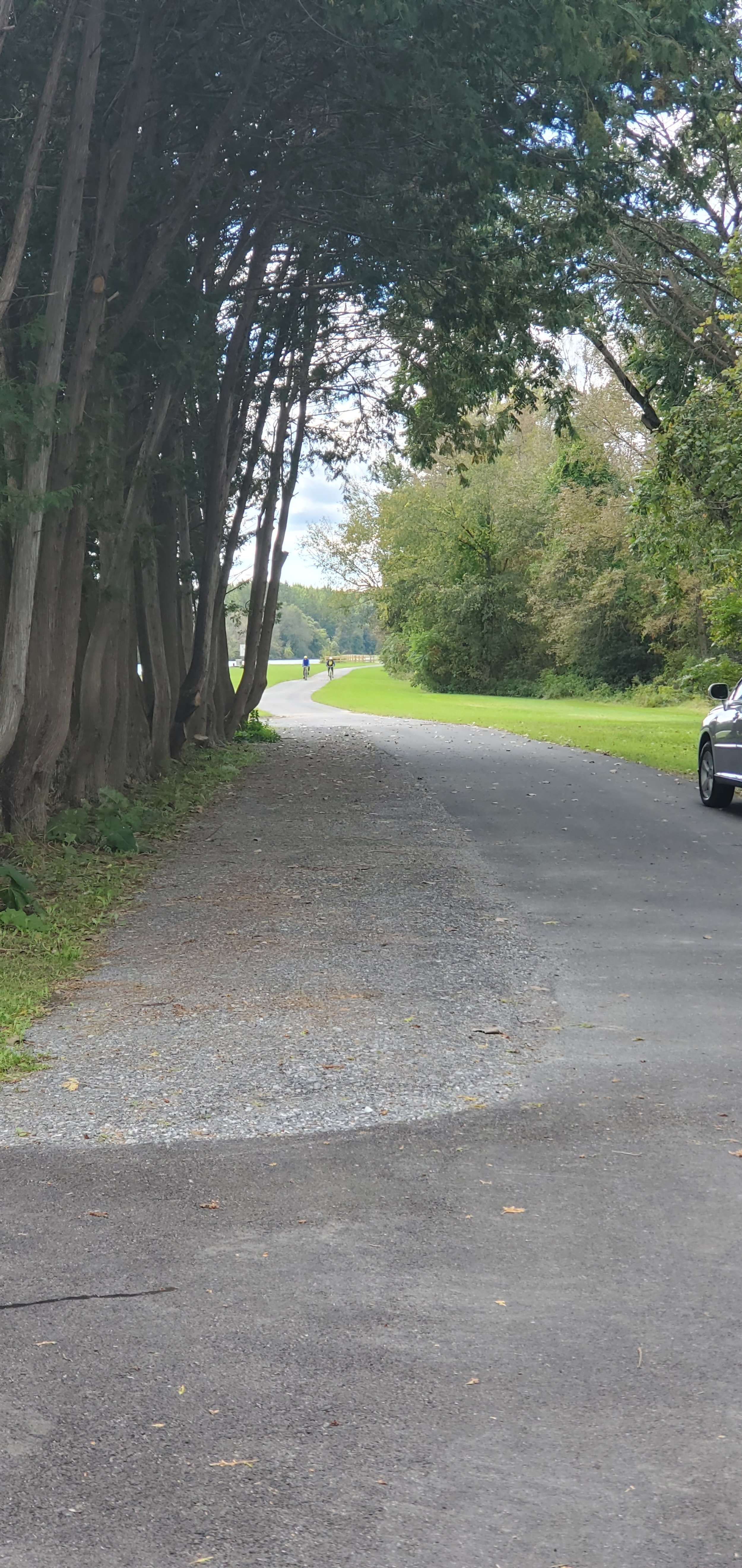
Lock C-9 in Fort Ann | Section of the Champlain Canal is an example of a well-maintained canal bank landscape (not an earthen embankment, because the bank does not rise above the surrounding area) where vegetation was removed as part of a broader project to rehabilitate the Empire State Trail. The Lock area has become very popular with people cycling, fishing, and camping since the maintenance work was completed.
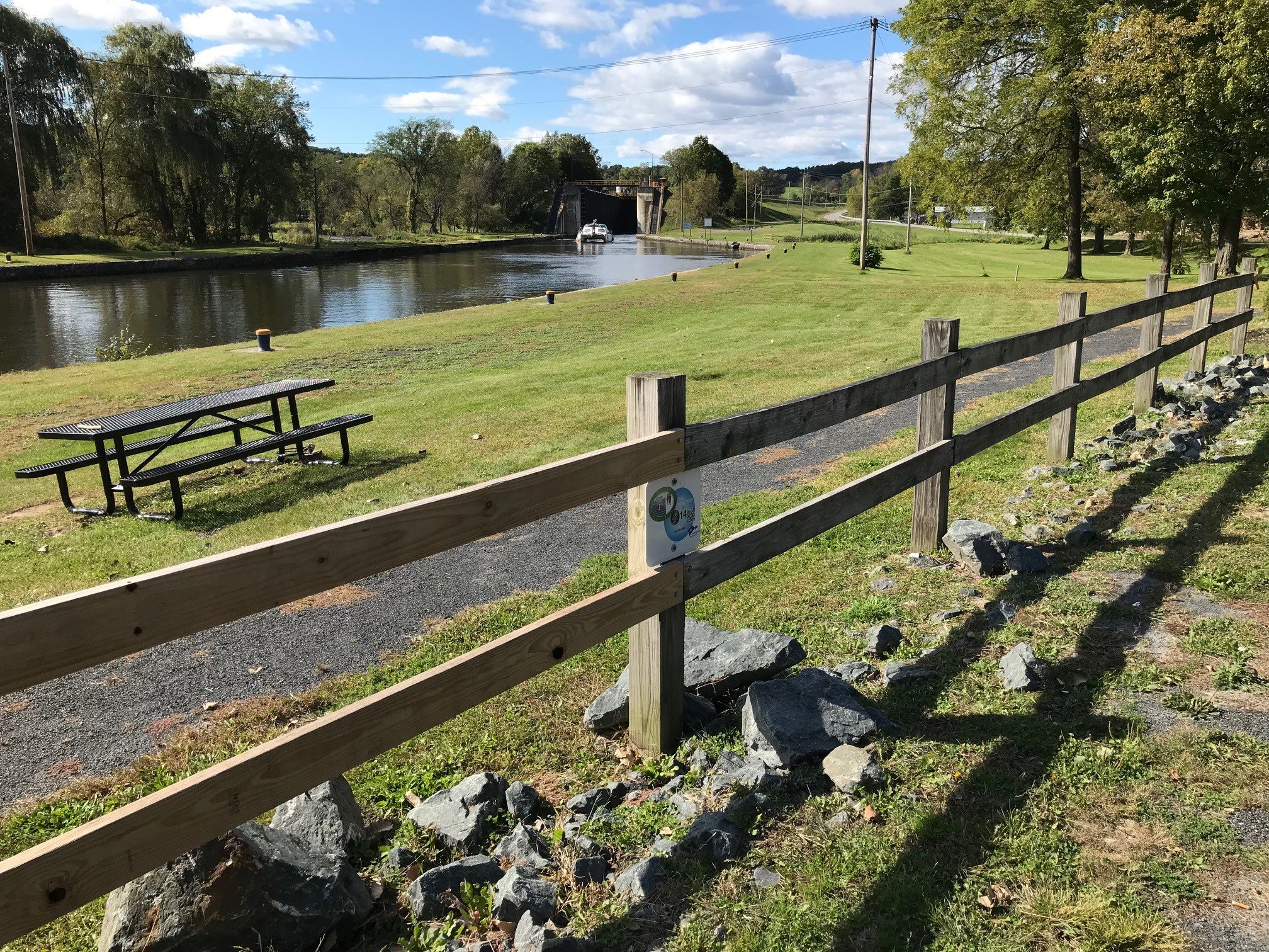
Lock E-4 in Waterford | This now well-maintained earthen embankment in the distance is part of Lock E-4 Dam, a high-hazard, Class C dam. In this location, dense bramble was removed and replaced with grass and a picnic area. The large, healthy, trees were preserved for shade and habitat. This is a good example of “selective clearing.” Trail users like the maintained area because it is safer and more welcoming.
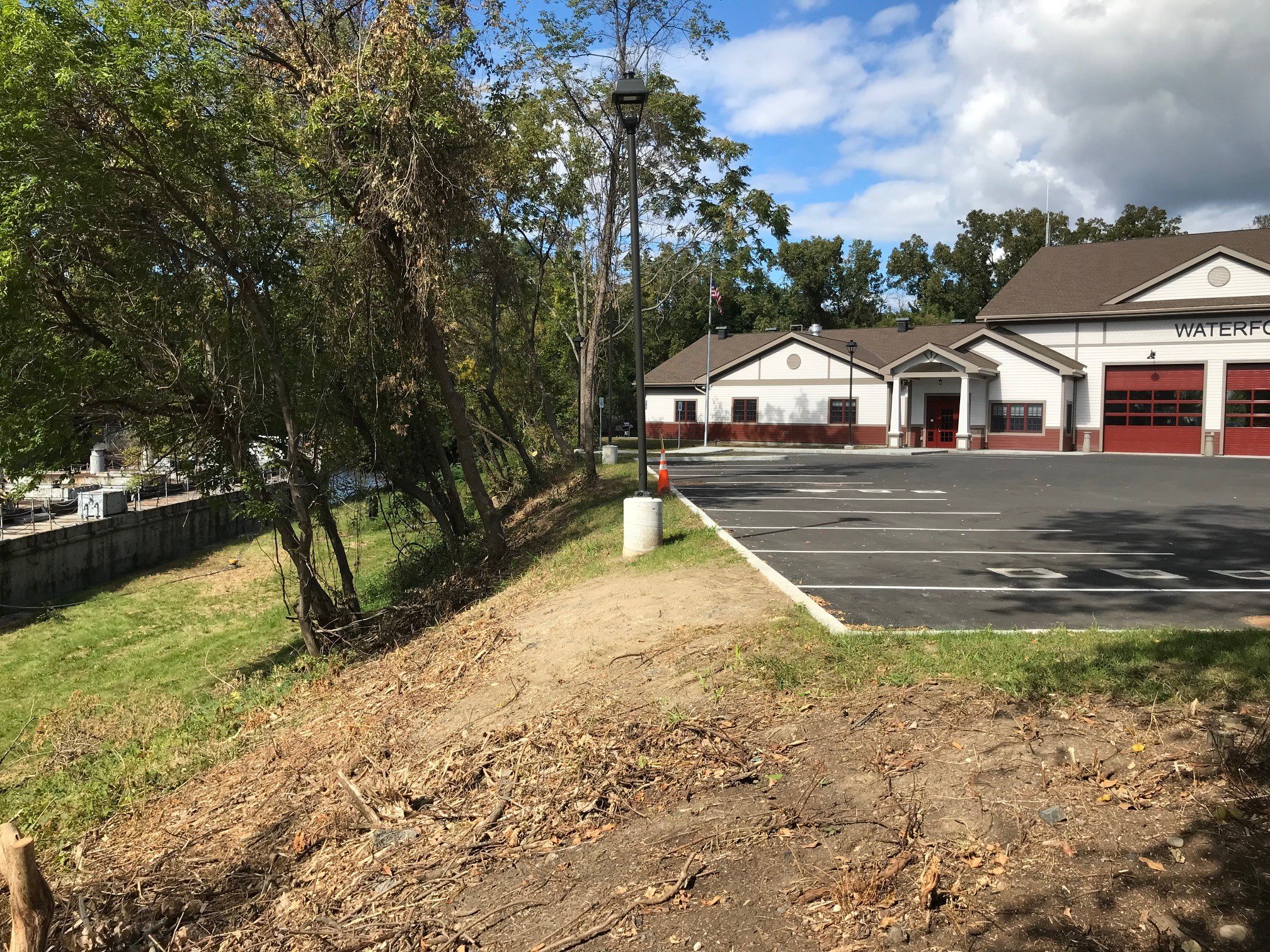
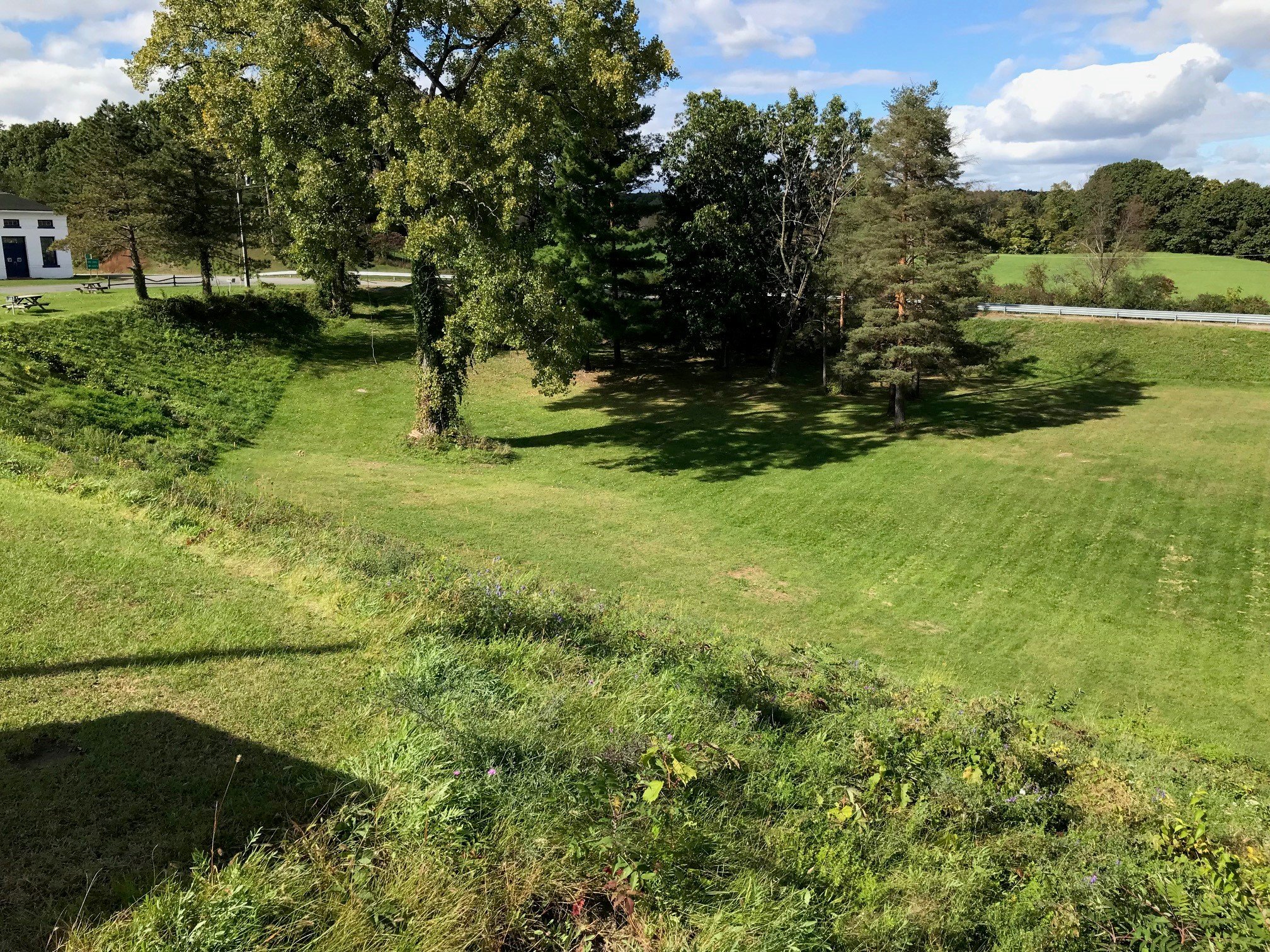
Between Locks E-2 and E-3, Waterford | Image depicts a recently cleared slope behind the Waterford Fire Station where dense vegetation was cleared but trees were preserved. In the next phase of the project, the slope will be covered in new grass. The Town is in favor of the maintenance because it affords views of the Canal that were previously impeded by growth. This is not an embankment dam but is a good example of selective clearing.
Earthen Embankment, Town of Gaines, NY | Example of a cleared and well-maintained earthen embankment slope east of Eagle Harbor. In this case, we can see the Empire State Trail on the tow path and a slope that is conducive to inspections, maintenance and emergency responders. Mowed grass provides a root structure that prevents erosion during periods of heavy rain.
Lock E-5 in Waterford | An example of an earthen embankment that was cleared of dense undergrowth in recent years. In this example, the outboard embankment slope and area beyond the toe of the dam are conducive to assessments and maintenance. Large, healthy, trees were preserved. Note: this dam is regulated under NYS DEC’s dam safety program, which is not the case for many other NYS Canal Corp embankment dams.
Earthen Embankment, Brockport, NY | An earthen embankment dam where the outboard slope was cleared previously. Unlike dams where the extent of clearing and restoration is extended 15 feet beyond the toe of slope, under the EEIP, clearing of earthen embankments is only extended to the limit of Canals property or 15 feet, whichever is less.
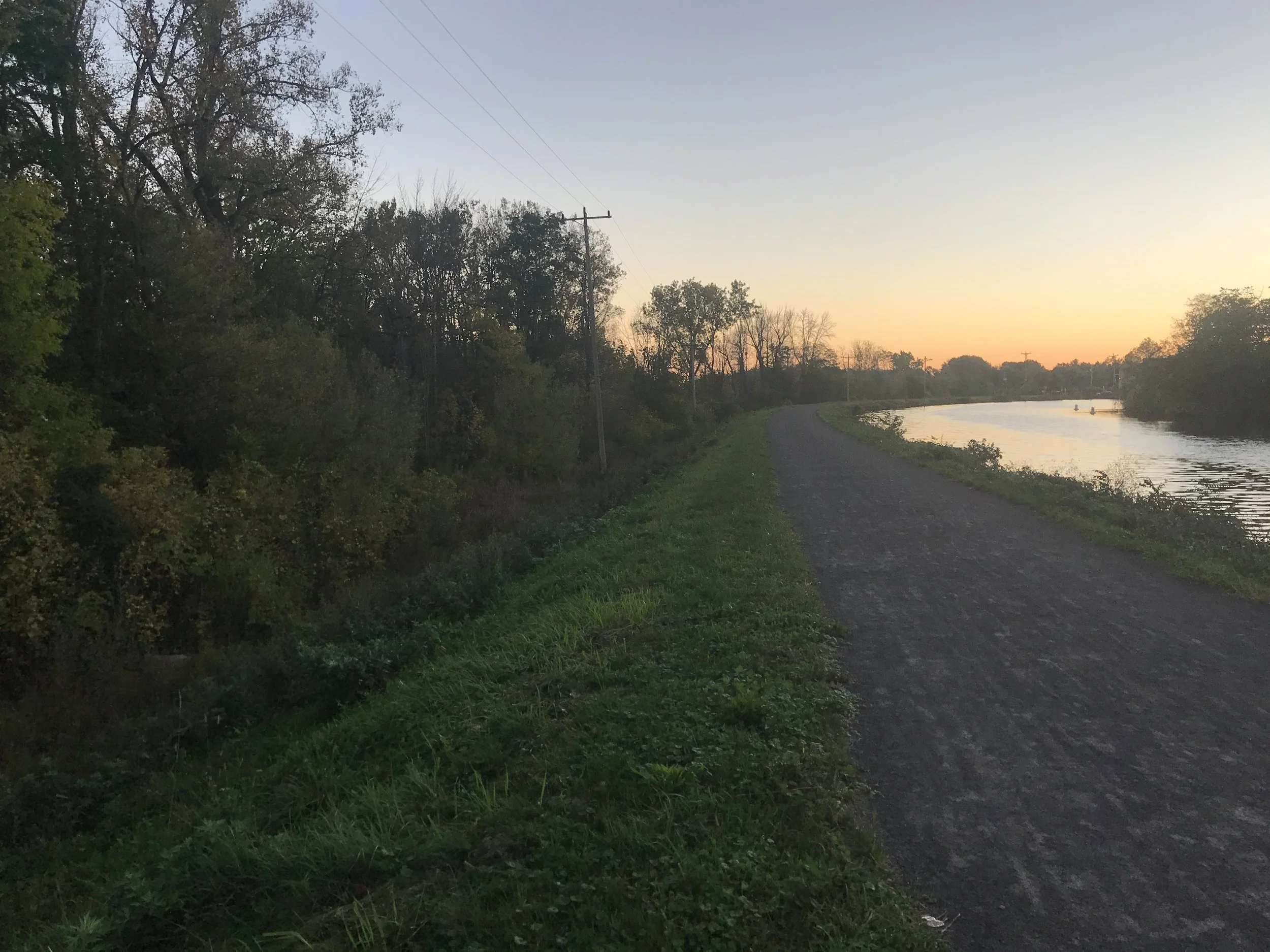
Erie Canal, Brockport, NY | Looking east from the trail, the north side of the Canal is an earthen embankment and the concrete wall on the south side is not.

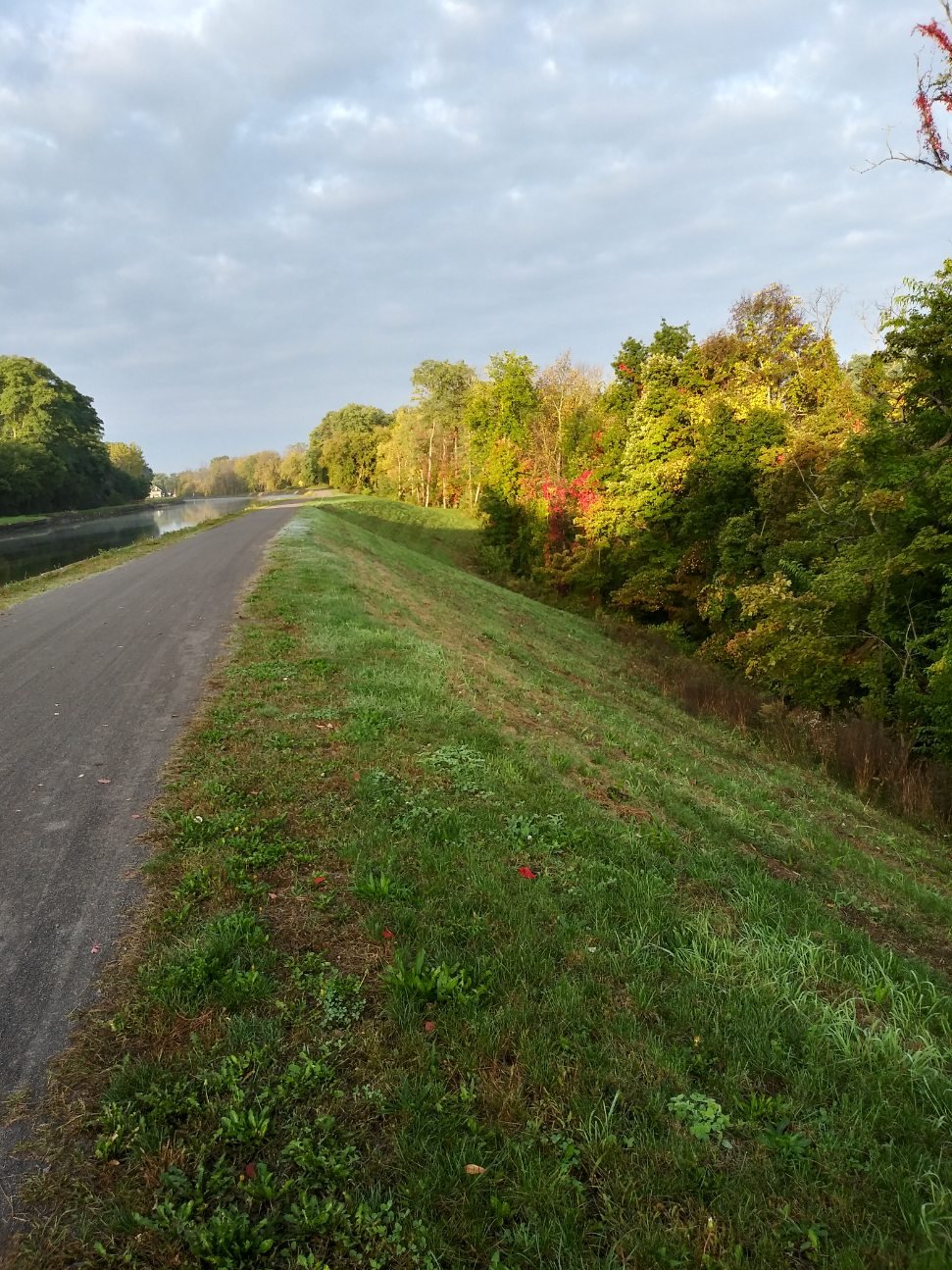
Outboard Slope of Earthen Embankment in Royalton, NY | This image is typical of an overgrown embankment, covered with dense bramble which impedes inspections for leaks and seeps. Pricker bushes, dead and fallen trees, and vines make it very difficult to perform maintenance. At full depth, the canal is 12’ deep on the other side of this earthen dam wall.

Known Seep in Royalton, NY | This image depicts an area on an outboard slope of an earthen embankment where a seep was detected. Once the dense ground vegetation was cleared, more than a dozen seeps were identified and are now being monitored or remediated. Seeps occur naturally on earthen embankments and are monitored for changes that can indicate a potential failure like a sudden washout.
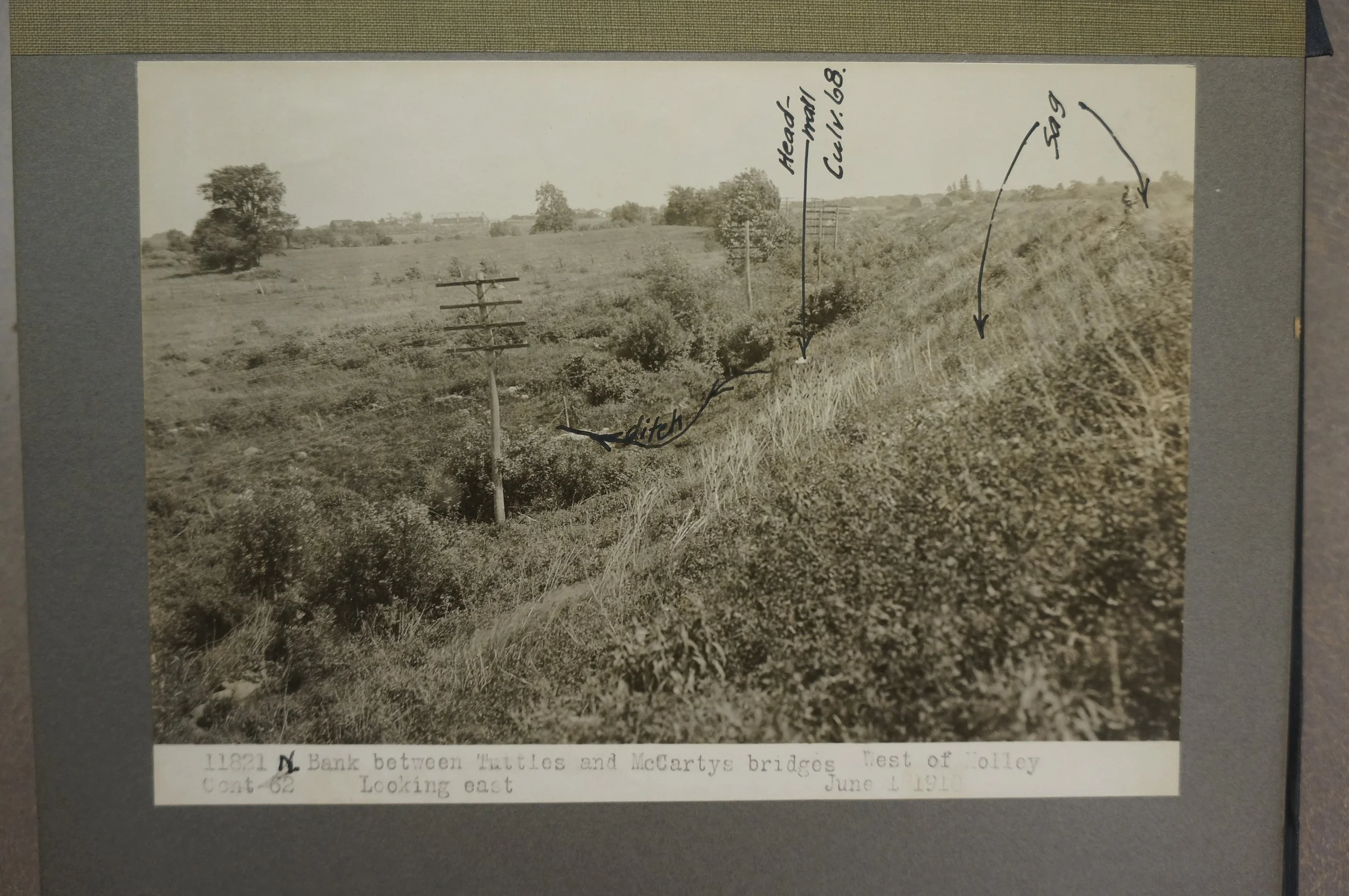
Earthen Embankment in rural Holley, NY | A 1918 image of the outboard slope of the earthen embankment.

Embankment Breach on May 19, 1911 Photo of embankment breach which occurred eight days after the completion of that section of the Barge Canal.
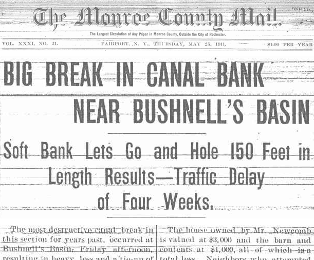
Headline on May 25, 1911 News of a 1911 embankment washout in Bushnell’s Basin. According to the Monroe County Mail article, a canal worker first discovered a seep in the embankment. The embankment gave way shortly thereafter. (photo from Rochestersubway.com)
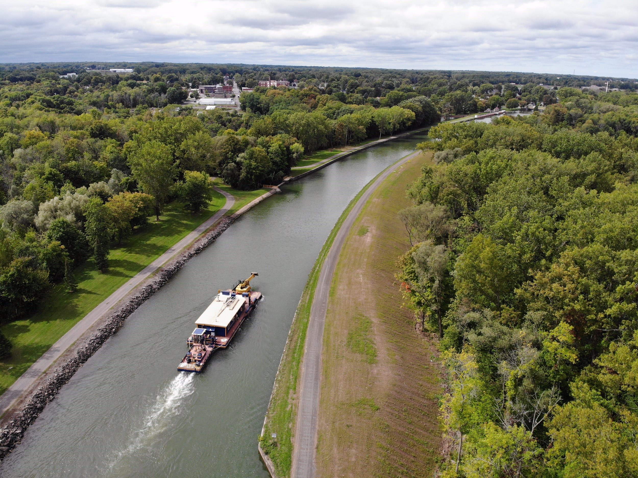
An aerial view of the Erie Canal in Holley, NY | In this image, the South side of the Canal is a concrete bank with riprap (stone) to slow erosion, then the Holley Waste Weir, followed by the Holley Dock Wall South. The North side of the Canal is an earthen embankment on the outboard side.